Discover Iran's Four Seasons: A Country of Year-Round Delights
Iran is a vast country with an endless history, hospitable people, and beautiful culture.
It is also a tourist treasure as it offers countless opportunities to explore different historic sites, mesmerizing architectures, serene deserts, green rainforests, spectacular tourist attractions, jagged mountains, and emerald jungles while enjoying the country's favorable climate.
It is good to know that Iran is a four-season country with a varied topography and different climatic regions. Iran offers different climatic conditions in every corner of the country. From hot summers in the south to freezing winters in the northwest and west, each corner of Iran has its particular climate condition. So you can travel to this beautiful country all year round.
As a traveler, you would want the best experience traveling to any destination, and factors like weather are undoubtedly relevant in providing that experience. For this reason, it would be interesting to know the climate in Iran and the best time to visit. Stay with us to learn more about Iran's four seasons and their unique features.
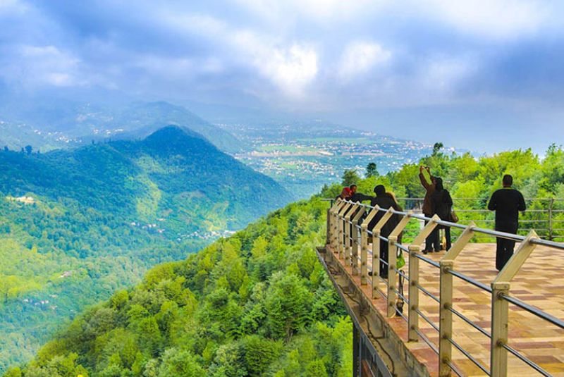
Calm and Lovely Springs of Iran
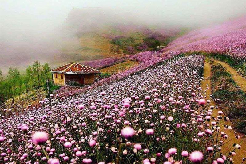
Generally, spring is when most of the rainfall falls throughout the year, making it the most pleasant Season for traveling to any destination, and traveling to Iran is no exception. Spring is the high Season for traveling to Iran. It starts from March to June.
The ideal temperature, pleasant fresh weather, and extended day hours make spring perfect for traveling across Iran. It is also the best time for outdoor activities and adventures in the deserts of Yazd. Spring is also ideal for visiting many of Shiraz's gardens and tourist attractions, like Persepolis, Eram Garden, and Nasir al-Mulk mosque.
It is the best time of the year to taste the culture of Iran and expose yourself to in-depth information on Iran's culture and civilization at Tehran Museums. The only downside of this Season is that prices will be higher.
Another exciting thing is that you can experience Iranian customs and celebrations like Golab Giri during this Season. So you may experience light crowds and cultural activities at that time.
| Read the complete article: Iran's Springtime - Where to Go and What to Do
Hot Summers in Iran
Summer days in Iran are pretty hot and are usually around July to September. The number of tourists declines during this Season, making it less crowded and polluted. So you get to spend more time with nature, enjoy healthier and cleaner air quality, and experience a unique culture during this time of the year.
Another advantage of summer is prices are often lower due to the hot weather throughout the country. It is also the best time to travel to the west and northwest of Iran because they have a fantastic climate and breathtaking landscapes. They usually experience freezing winter and pleasant summer. So you can participate in trekking, mountain climbing, and swimming in some of the most relaxing hot springs in the northwest of Iran.
In addition, you can explore stunning jungles, rivers, and waterfalls in Aras Baran forests in Azerbaijan province and Kurdistan province, letting you experience adventure and camping in nature.
| Read the complete article: Summer in Iran - Caspian Coolness or Desert Heat?
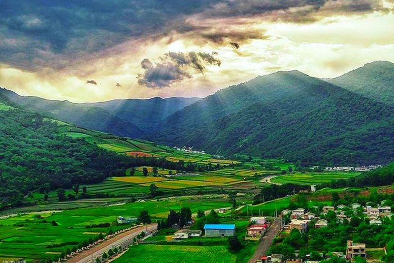
Iran's Cool and Pleasant Autumn
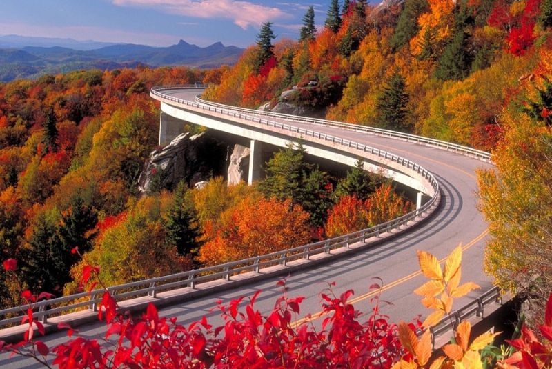
Autumn is also one of the best seasons to visit Iran, as its cool breezes and favorable climate call for many tourists to come and visit Iran. Autumn typically falls around late September to early December. During this Season, the temperature drops, rainfall is sporadic, and the weather gets cooler, especially at the end of October and early November.
Autumn is the best time for enjoying the dunes and desert tours in Iran. It also gives you a real-time adventure in the desert. There are also few crowds because the Iranian school holidays finish around the end of September. Prices will be higher than in summer but quite fair compared to the spring season. Public transportation, including flights and trains, is easily accessible because there are almost few non-business domestic travel during this period.
Autumn also offers a desirable opportunity for all tours to Iran, ranging from cultural tours, mainly in the central parts of Iran, to many adventure tours such as trekking, hiking, and even birdwatching in some lagoons and biosphere reserves in Iran.
| Read the complete article: 13 Best Autumn Destinations in Iran
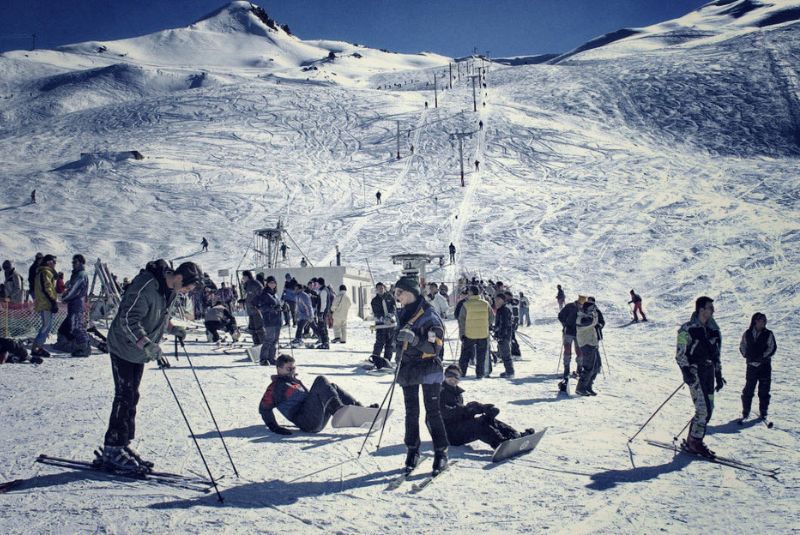
Cold and Freezing Winters in Iran
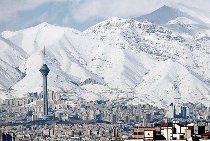
Being on a budget destination, high altitudes, and good quality powdery snow are convincing reasons tourists choose Iran for their next ski destination. This Season is the best time to Ski in the north, and it is the best time for sightseeing in the south of Iran, which is still warm and pleasant.
Winter falls around late December to late February. It is also the best time to travel to Iran for lovers of colorful nature and snowy places, as Iran enjoys freezing winters and snowfall in nearly all provinces. However, the southern coastline of the Persian Gulf is almost an exception.
You can enjoy beautiful weather, exciting water sports, and fishing or spend time on the astonishingly beautiful coral beaches of the Persian Gulf islands. Tourists usually choose the beautiful coral beaches of southern islands, including Qeshm and Kish, as their winter destinations.
Winter in Iran is like heaven for many adventurers around the world because not only does it provide an ideal climate condition, but it also lets them witness without the tourists. In addition, you get to experience the magical white-capped peaks and frosty mornings in Iran. The whole country's Landscapes look like something out of a fairy tale when dusted in snow.
You will also save more money because prices are pretty low in winter. Many hotels and resorts also offer great deals for those who want to visit during this Season, so if you are interested in saving money, this would be the best time for you.
One of the cultural experiences in the winter is the Iranian festival called Shab-e Chelleh or Yaldā, which is the longest night of the year. On this night, Iranian families and friends celebrate by reading famous poems, especially poems by Hafez, and eating nuts, pomegranates, and watermelon.
The only disadvantage of winter in Iran is not the cold or rainfall but the air pollution in most metropolises, especially in Tehran.
| Read the complete article: Winters in Iran - Top Places to Visit + Photos
What is the Best Season to Visit Iran?
The best Season to visit Iran largely depends on the specific regions and activities you plan to engage in during your visit. However, the best Season to visit is during spring when the weather is mild, and the landscapes come alive with vibrant colors as flowers bloom. Spring is also an excellent season for hiking in the Alborz Mountains or visiting beautiful Iranian gardens. Autumn is another great season to visit Iran, with pleasant temperatures and colorful landscapes making it an ideal time to explore ancient sites like Persepolis.
What is the Peak Tourism Season in Iran?
The peak tourism season in Iran occurs during March and May, which fall within the spring season. One of the main reasons why March to May is so popular among tourists is the pleasant climate.
In addition to the favorable weather, this Season coincides with several cultural events and festivities. One such event is Nowruz, the Persian New Year, which takes place around March 21st.
Hence, popular tourist destinations in Iran can get quite crowded. Cities like Tehran, Isfahan, and Shiraz witness an influx of visitors worldwide.
Tips for Traveling to Iran During the High Season
- Plan and book in advance: Due to the high number of tourists, planning your trip well in advance is advisable. Book your accommodations, flights, and any tours or activities you wish to participate in to secure your preferred options.
- Apply for a visa early: Make sure to apply for an Iranian visa well ahead of your travel dates. Due to many applicants, the visa process may take some time, so it's best to start early to avoid any last-minute complications.
- Be prepared for crowds: The high season means popular tourist destinations can get crowded. Be patient and give yourself extra time to explore attractions, especially in cities like Tehran, Isfahan, and Shiraz.
- Learn a few basic phrases in Farsi: While many Iranians can speak English, knowing a few basic phrases in Farsi can go a long way in communicating and connecting with locals.
- Stay informed about local customs and regulations: Before traveling to Iran, stay updated on the latest travel advisories, customs regulations, and any specific guidelines for tourists. This will help you have a smooth and hassle-free experience during your visit.
| Read more: Iran Travel Tips
Bottom Line
Iran is a country with four seasons, offering a rich and diverse experience throughout its four seasons. From the snow-covered mountains of winter to the vibrant blossoms of spring, Iran brings unique charm and exploration opportunities.
The four seasons in Iran also offer a chance to witness and participate in a wide range of activities and experiences, from skiing in the Alborz Mountains to swimming in the azure waters of the Persian Gulf, from strolling through ancient bazaars to hiking in lush valleys.
As a country with a profound historical and cultural legacy, natural wonders, and warm hospitality, Iran continues to captivate and inspire travelers worldwide. Its four seasons ensure there is never a wrong time to visit, as each offers a unique perspective on this remarkable destination, with spring being the best among them.
Share your story!
Comment below and let us know about your Experience.
Your story inspires others!


Comment
Leave a Comment